

Firenze dove, cosa... Km4City app for iPhone and iPad
Developer: Universita Degli Studi Di Firenze
First release : 13 Aug 2015
App size: 96.59 Mb
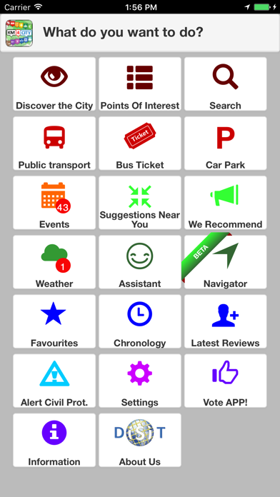
A personal assistant that shows the services that are close to your location, browse in the city, located restaurants, bathrooms, free WiFi, bicycle, parks, digital location, delays on some bus lines, car parks, pharmacies, ATMs, events, etc. buy bus tickets in Tuscany, Florence, Pisa, Arezzo, Siena, Prato, ...
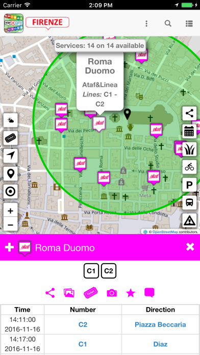
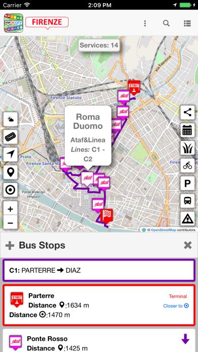
The services are accessible geo related to transport and mobility, cultural heritage, hospitals, weather, services, bus stops and waiting times, banks, digital location, energy, and much else, free space parking, fuel prices on stations, etc. with images, audio and documents.
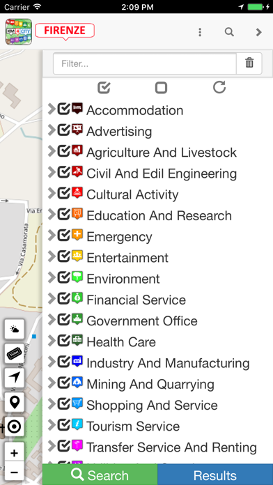
The data available are listed in http://www.disit.org/6726 and you have more than 100,000 services in Florence, Pisa, Prato, Pistoia, Arezzo, Empoli city, and all of Tuscany. Concern throughout Tuscany, with particular regard to the province of Florence, and come from the MHC region of Tuscany, the LAMMA, observatory Transportation and traffic manager, by the city, etc.
On Km4City, you can find many open data on all municipalities in Tuscany and Florence, http://www.km4city.org. For developers use http://servicemap.disit.org.
Km4City consists in a scalable and efficient to deliver innovative services by (i) providing integrated data / aggregates and (ii) allowing the integration of private data or specific data with open; API services with simple and effective to develop mobile applications and web using consistently data, by providing a constant channel of aggregate data updated. Km4City includes development tools and production and is based on the model Km4City (http://www.disit.org/km4city) and a series of tools that have been developed and are currently in use in the aggregator of Florence developed by DISIT Lab, accessible via http://servicemap.disit.org (and also accessible with API). The solution Km4City is used in projects Sii-Mobility smart city national and RESOLUTE H2020.
The application Km4City measures Wi-Fi signals and BT in the city and communicates them to a central server in a completely anonymous manner, which only serves to map the wifi/BT of the city.
This App provides suggestions based on the user profile selected (citizen, commuter, tourist, student, and all). Again, the application is not use your personal ID, identifying yourself, but only your generic profile without connection to your personal data, in respect of privacy. Suggestions are related to: events, weather forecast, mobility, interesting issue to be done, utilities, accommodations, restaurants, etc. YYou can customize your preferences, and the system learns your them.
This application was developed using the services and APIs Km4City (http://www.disit.org/km4city) from DISIT Lab of the University of Florence (http://www.disit.dinfo.unifi.it ). It aims to provide updated information on the city. Km4City of companies and institutions can integrate information open, private, sensitive and / or critical in a contextualized way with those accessible to the city and create new services for their qualified personnel and / or for the citizen. And possible to develop App and web pages that use these services in a simple and fast. The primary tool on the web is accessible from http://servicemap.disit.org.
A web version of the app is available directly http://www.km4city.org
Using this application you are implicitly confirming your consent to these measurements. You can disable the measurements and recommendation on the settings. We thank you for allowing us to acquire these data that will be used to improve services in the city and for research.
DISIT not guarantee that the service today called active http://servicemap.disit.org, and km4city, they can remain in the same form and / or active forever. For information contact [email protected].